 The Medford Trail
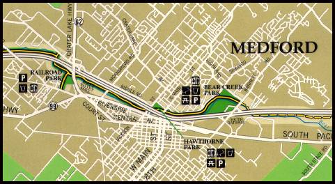
THIRTY-SEVEN MILLION YEARS AGO, fast flowing rivers from the early Klamath-Siskiyou range began depositing sand and gravel which, with time, became cemented together to form sedimentary rocks. These layers of sandstone are now called the Payne Cliff Formation, named after the high cliffs across the freeway to the north. This vein of sandstone extends through bear Creek Valley and can be seen running along the side of the hills to the north.
Because these sedimentary rocks are softer than both the metamorphic Klamaths to the south and the volcanic Cascades to the north, the ancestral Bear Creek carved the valley we now see through the less resistant sedimentary rocks.
Bear Creek begins at the confluence of Emigrant and Neil Creeks southeast of Ashland, and flows through the heart of the valley until it enters the Rogue River near Lower Table Rock. It has provided a convenient path over the years, first for Native Americans and later for Euro-American explorers, trappers, and settlers.
The Medford section of the Bear Creek Greenway begins at Bear Creek Park, just off the South Medford I-5 Interchange.
It continues through Bear Creek Park, along a short wild area, to Hawthorne Park, in central Medford. From there it goes under the freeway and other streets, to the irrigation dam and another wild area. It goes around and under the North Medford I-5 Interchange, along another wild area, and ends at Railroad Park. Eighteen marked stations follow the guidebook.
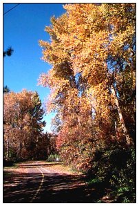


Photo by D.L. Mark.