


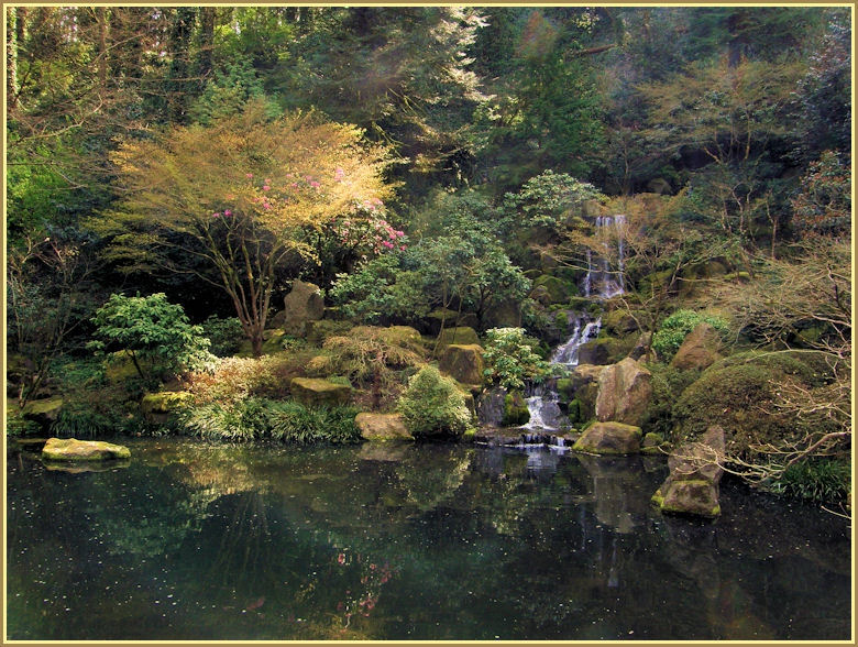


More of Don's
photo series.
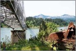
Bridge of the Gods
From the Oregon side
Bridge of the Gods Looking Across the River Table Mountain and Greenleaf Peak Table Mountain
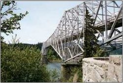
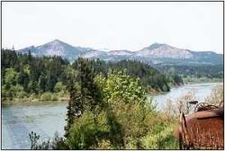
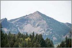
Five hundred years ago Table Mountain and Greenleaf Peak, the mountains in the pictures above, split in two; the southern halves of them slid down the mountain and into the Columbia, forming a dam. Water filled up to 80 feet deep. When the dam burst, the water rushed downstream in a torrent, scouring the landscape and destroying natives and their villages. Rapids, or cascades, from which the Cascade Mountains get their name, were formed, and were a barrier to navigation until the late 1890's, when Cascade Locks were built. Bonneville Dam, built in the 1930's, has produced lots of electricity, but has severely damaged fisheries.
The landslide and dam diverted the channel of the Columbia a mile to the south, which you can see, especially in "Looking Across the River." Lewis and Clark and the pioneers had a very difficult time traversing this area.
The name of the bridge comes from Indian legends, which refer to the bridge of the gods, probably referring to the landslide. The man-made bridge was named after the natural bridge, probably a causeway or dam. I recall an interesting story which occurred near the end of World War II. A reporter for a Portland newspaper heard a news bulletin which said Berchtesgarten, Hitler's resort, had fallen. The reporter thought it said, "Bridge of the Gods has fallen." He headed out there (40+ miles, and gasoline rationing) only to find the bridge still standing, and embarrassed but happy that the bridge still stood.
I don't think the bridge itself is anything special, but is famous because of its location. Work began in 1920; it took six years to build. The bridge was privately owned until 1961, when it was purchased by the Port of Cascade Locks. The Pacific Crest Trail crosses the bridge, which is 1,858 feet long and 135 feet above the water. It'll cost you fifty cents to walk across (no sidewalk). That might be fun; you walk on the steel bridge grid, and can see straight down into the water. Toll is a dollar for a car.
I received this email message the other day. I thought you might enjoy it also.
“I was searching the Web for some information about the bridge, and came across your site as one of the links. After reading what you had to say about the bridge, I thought you would like some additional info about it.
Apparently my grandfather helped build the Bridge of the Gods. You must remember that they had not dammed the river at this time. It was a wild river at the time of construction. It was very dangerous work. I don't know how many men died during the construction of the bridge, but several did. My grandfather was one of the lucky ones: he fell off the bridge during construction, and was swept about a mile downstream but managed to get to shore. My mother told me that she saw her father after he came home from falling off the bridge; he had hit the water backside first and was black and blue from his shoulders to his feet.
I just thought you would like some additional information about the bridge, because constructing a bridge across the untamed Columbia was something pretty special.
Sincerely,
Sandra”
| Previous | Index | Next |