


More of Don's
photo series.
Flaming Gorge National Recreation Area
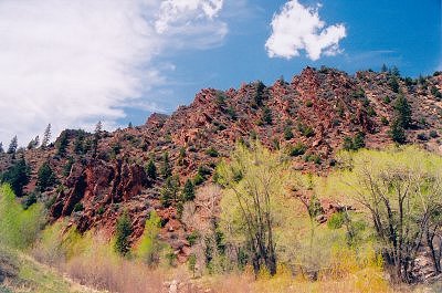
Flaming Gorge Dam impounds the waters of the Green River in southern Wyoming and northern Utah. Mainly the part I found interesting was the geologic area which is not actually in Flaming Gorge NRA but you access it from the same road.
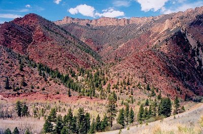
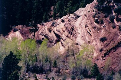
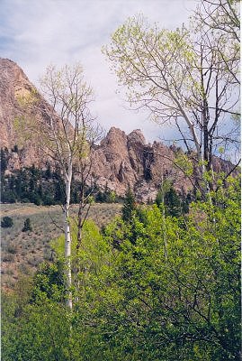
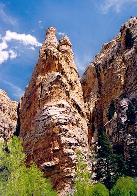
As you no doubt already know, the earth--at least the upper parts--is composed of layers, like on a layer cake. The layers are formed from dust settling, lakebeds and seabeds drying up, floods, etc., over long periods of time. Well, in this area the layers are not only more visible than most other places, they are also tipped over, jumbled up, turned upside down, and messed up in general. It's like someone dropped a layer cake and stepped on it, then tried to put it back together.
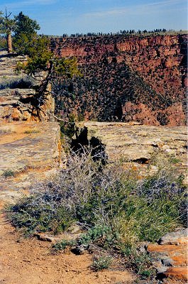
The visitor center is located on a cliff above the Green River. It is built out over large cracks in the mountain, which you can easily see in the photo below. It is really eerie to walk out on those rocks, when you can see that they are broken off from the mountain, but not clear off yet. Any day.
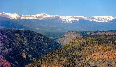
Here you can see the waters impounded by the Green River 1000' below. This water is heavy in sodium; it is water which is used by the people from here to Mexico for all purposes. If you live in Utah, Arizona, S. California, or northern Mexico, better have your blood pressure checked regularly.
The mountains in the distance are the Uintas, pronounced "you in-tas," without a "w" (not "you-win-tas.") The Uintas are the only major range of mountains in North America which run east-to-west; all the others run more-or-less north-to-south.
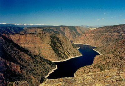
The Uintas aren't piddling little hills: the highest is 13,528' and about ten more are above 13,000'.
Acadia | Arches | Appomattox Court House | Black Canyon of the Gunnison | Bryce Canyon | Canyonlands | Capitol Reef | Crater Lake | Flaming Gorge | Fort Vancouver | Gettysburg National Military Park | Glacier | Grand Canyon | Grand Staircase Escalante | Grand Teton | Great Basin | Jefferson National Expansion | Joshua Tree | Lassen Volcanic | Mesa Verde | Mount Rainier | Mount Rushmore | North Cascades | Olympic | Redwood | Rocky Mountain | San Rafael Swell | Sequoia and Kings Canyon | Yellowstone | Yosemite | Zion | National Parks Index | Don's Web Site Home Page |