


More of Don's
photo series.
Mount St. Helens
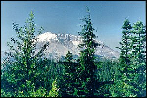
Mount St. Helens was, prior to the eruption of 1980, one of the most beautiful of the Cascade Peaks. It was symmetrical and round at the top, eminently photographable. It was over ten thousand feet tall, which is why it is included here. Now it is a mere 8,366 feet, and not nearly so lovely.
St. Helens is still an interesting mountain, though. There are three places to see it from up close: Johnston Ridge, which is accessed from I-5 at Castle Rock, Washington; Windy Ridge, accessed from US 12 at Randle, Washington; and the Cougar area, accessed from I-5 at Woodland, from Randle, or from Trout Lake off SR 14 on SR 141.
- JOHNSTON RIDGE
The road in is breathtaking. You keep seeing Mount St. Helens getting closer and closer. There are three or four visitor's centers, and quite a few viewpoints.
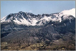
As you come closer to the mountain, you can see the devastation which occurred in 1980 when Mount St. Helens erupted.
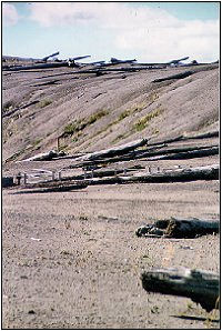
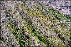
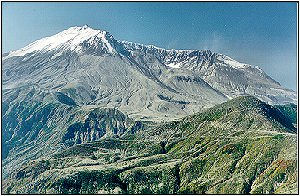
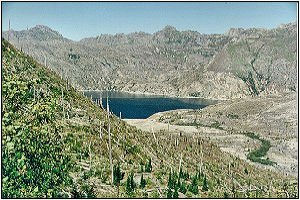
The little green clumps in the first photo below are actually trees; the gray sticks are logs. The second photo is the crater itself. You can see the lava dome growing inside it. St. Helens is still a very active volcano.
- WINDY RIDGE
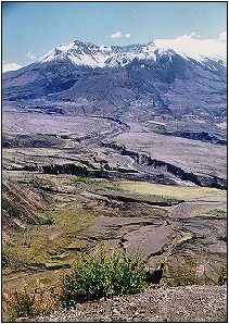
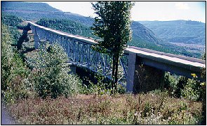
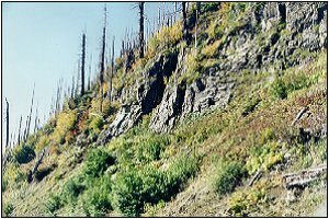
I thought the road in from I-5 to Johnston Ridge was spectacular; the road in to Windy Ridge is absolutely vertiginous! It is sort of boring until you get to the Windy Ridge part of it; after that, it climbs and winds up the side of the mountain, without guard rails, and with sheer cliffs you hope you don't drive off of. On the way up, on the inside of the road, it occurred to me that I would have to drive back down, on the cliff side. And me with vertigo, terrified of heights! "Why on earth did I decide to photograph mountains??" I wondered. (Actually, the photo below (left) doesn't do the road justice.) The second photo below shows the renewal of vegetation over the last 17 years or so.
This Spirit Lake (below) formed after the original Spirit Lake was destroyed by the eruption. The area around the lake is either still nearly barren or beginning to grow back.
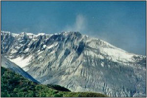
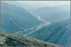
The summit. Is that steam coming out of there, or is it just a cloud forming? I don't know. The photo on the right is of the Smith Creek Valley, I think, which flows from the east side of the mountain. You can also get an idea here of the height of the road above the valley, and the steepness of the cliff.
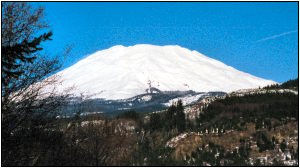
- COUGAR
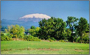
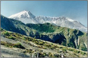
On this November day the mountain stood out clearly, as you can see. This is St. Helens from about 15 miles south, slightly west. The eruption pretty much left this side of the mountain alone, except that it took the top off.
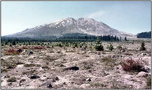
These two views are from almost the same direction; not quite. The summer shot is from only 5 or 6 miles away--at Lahar Viewpoint.
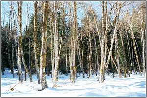
The forest is from nearby, at the point where the road is closed in winter.
Mount St. Helens has had many names. The Klickitat Indians called it Tah-one-lat-clah, Fire Mountain. To their neighbors the Cowlitz Indians it was Kaw-we-lai-klah, Smoker. Europeans, hearing the legends of the local tribes, called it Loowit, Keeper of the Fire. Lord St. Helens, whose name was Alleyne Fitzherbert, of all things, was a friend of Captain Vancouver, who renamed it after him. [I see in John Adams, by David McCullough, that Alleyne Fitzherbert was on the British diplomatic team which negotiated the terms of settlement of the American Revolution. I guess he deserves to have a mountain named after him. The US did pretty well in those negotiations.]
Interactive maps, photos, information are available at the USGS site.
©D.L. Mark 1997