


More of Don's
photo series.
Mount Mazama
Crater Lake National Park
A brief history of Mount Mazama:Grew,
Blew,
Fell,
Filled.
—Ranger at Crater Lake
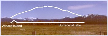
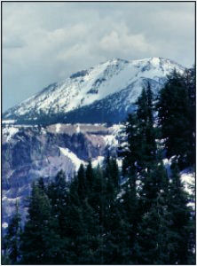
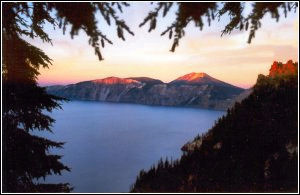
Mount Mazama as it is today. Prior to about 7,000 years ago you would have seen a 12,000 foot volcano, snow capped year around, in front of you. But then, in the manner of Cascade volcanoes, it erupted so violently that rocks were hurled as far away as Saskatchewan. Avalanches of hot rocks spewed forth, creating the flat valley you see here. Then what was left of Mount Mazama collapsed, forming a 7 mile wide caldera.
Gradually the caldera filled with water from rain and melting snow, to a level where evaporation equals rainfall plus snowmelt. The bottom of the lake is about at the same level as the flat surface in the picture; the surface of the lake is about two thousand feet higher. The lake is, of course, Crater Lake. The larger island in the lake is called Wizard Island and is a cinder cone from a more recent eruption.
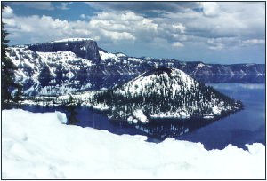
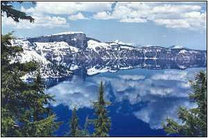
Views from the short rim trail in the Crater Lake Village area.
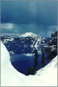
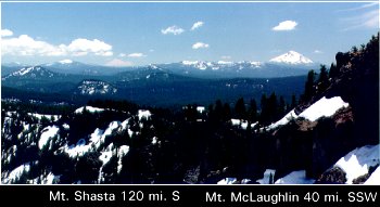
Looking south from near The Watchman. Mount Shasta and Mount McLoughlin are both visible. But you have to really look to find Shasta.
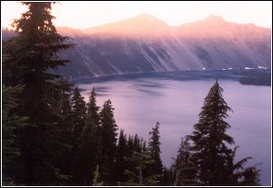
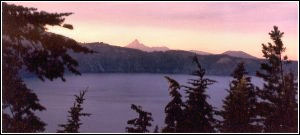
Crater Lake should be visited at different times of day as well as at different seasons.
Cascade Peaks Index or the Crater Lake National Park page.